
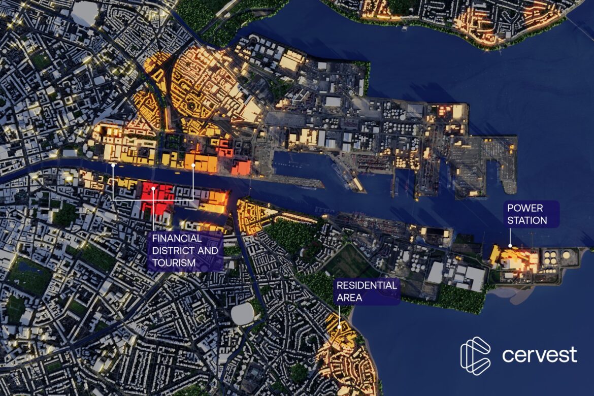
By 2100, more than 8 500 buildings will be affected by coastal flooding in Dublin’s Central Area, with an average depth of 1.7 meters. Speaking at the recent Dublin Climate Summit 2022, Cervest founder and CEO Iggy Bassi highlighted areas at risk as businesses (hotels, museums, financial district), private property (residential homes) and energy suppliers (power stations).
Using their advanced data visualization capabilities, Cervest created a 3D image to highlight flooding risk over the area by that time. The image presents a business as usual climate scenario with risk shown on a continuous scale, where light yellow represents lowest risk and dark red the highest risk.
The image stands as a powerful visual and emotional reminder of what can happen if climate change is left unchecked.
Cervest’s Advanced Data Visualization team says this image considers only the risk associated with coastal flooding. When other climate hazards are added, such as extreme heat and wind stress, increasingly larger areas of Dublin will be affected. “This visualization shows a business as usual scenario. If mitigation policies, such as making good on national emissions reduction commitments, deforestation pledges and implementing mandatory legislation on reporting standards are applied in the near future, this scenario might change.
Armed with EarthScan’s on-demand, science-based Climate Intelligence insights, everyone can make better decisions about everything from building resilience, to city planning, to insurance coverage, to identifying where – and where not – to build.